GPX ( GPS eXchange Format ) is a common GPS data format with an XML schema that can be used to exchange GPS data between various applications, and to share GPS data with other services such as Web-based services. GPX files can be used to describe waypoints , routes , and tracks . Unlike other data file formats, which only the program concerned can understand, GPX files are an open format so anyone can create programs that can read the data in the gpx file.
To be readable by ArcGis, the gpx file must first be converted to a shapefile format . There are various applications that can do this conversion, including DNRGarmin and Global Mapper . ArcGis itself actually already provides an extension that can read the gpx file. It's just that sometimes ArcGis (especially version 9.x) can't read the gpx format stored directly by the Mapsource application correctly, so we need another program that can convert gpx into shapefile format or save it back in gpx format and then convert it by the Arcgis extension. .
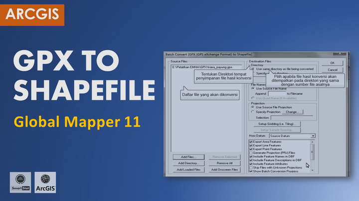
In this tutorial, we will describe the steps for converting GPX files into shapefile format using Global Mapper 11.
You can learn more about GIS tutorial: Convert GPX to Shapefile with Global Mapper in the following video.
![]()
GIS Tutorial: Convert GPX to Shapefile with Global Mapper
GIS Tutorial: Convert GPX to Shapefile with Global Mapper
If you are interested in GIS Tutorial: Convert GPX to Shapefile with Global Mapper , please subscribe to Smartstat Channel: https://youtube.com/user/smartstatistik